
The Davies, Route 5.
Pitel #44, Mozgovishki Chukar #45#46#47#49
Mozgovishki Chukar has proved to be one of the hardest routes to put together for The Davies. It isn’t the most technically challenging route or the longest. Those titles probably go to Yalovarnika #55 and Golena #58. But route 4 poses it’s own unique chalenges.
After 10 attempts I finally made it with one of my strongest hiking buddies. After a very early start, with rope packed just in case. There are two possible start points, one is from Tevno hut from where you will have to follow the red trail towards Vihren to the pass east of Pitel #44 and the other is from Damianitsa hut. The route I will describe is from Damianitsa hut.
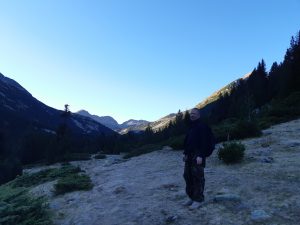
To get to Damianitsa hut drive ( or be driven) by 4×4 up the dirt road to the hut. It is a long day so saving a couple of hours by driving is well worth it. We left Bansko in the dark and returned in the dark in October, this is a 10 to 12 hour day so allow Plenty of time.
From the hut head due south on on the blue trail. Most of the way the trail is also marked by black and yellow winter trail poles. These poles are on most of the main winter ski mountaineering routes and have distances to the next post on the little sign at the top of the pole.
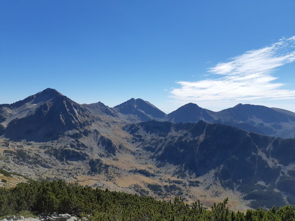
The trail follows the valley floor towards the u shaped pass at the head of the valley. This is alpine pasture grazed all summer by the local cattle, you get some great views looking back towards Bansko and east towards Gazai#68 and Djangal#87. After you pass the yellow trail that comes down from Djangal to the east there is the first little climb up to a small lake. From here on you are off piste and there are no trail markers until you come back to this little lake.
 At the lake you will see a faint trail the heads due west up to the ridge, the trail gets fainter and fainter as it nears the top of the ridge. At the top you will meet the main motorway trail that goes the whole length of Pirin. This section of the red trail goes from Vihren hut to Tevno hut and is one of the most popular trails in National Park Pirin. Peak summer this is a busy motorway full of hut to hut holiday makers. Cross the red trail and head down towards the lake at the foot of Pitel. There is a kind of faint trail here but any route will do.
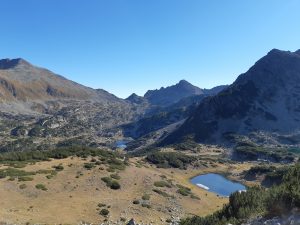
The valley below the lake leads to Sandanski and the hut at Spano Pole ( pronounced Spano Polay) From the lake you get a good view of Pitel. It looks impossible from here, don’t worry there is a way. From the north shore of the lake head straight toward the summit of Pitel. You will soon come up against a wall of impenetrable klek. Skirt round to the west and keep climbing up the north ridge, repeat this every time you hit klek and you will curve easily to the summit. The summit of Pitel is covered in “small” boulders, It is pretty easy scrambling here. 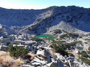
We spent a huge amount of time on the summit of Pitel trying to find a route onto the main ridge, as it turned out the most direct route was the best but it looks pretty grim from Pitel. From the summit follow the ridge line due south dropping down onto the west flank to miss the worst of the klek. You will have to scramble at times but nothing too scary. You are aiming for the saddle where Pitel joins the Mozgovishki Chukar ridge. Just before the saddle you will have to skirt along the east flank then scamble back up onto the main ridge. The ridge is steep but easy scrambling. It took us about 45 minutes from the Summit of Pitel to peak#46 on Mozgovishki Chukar. 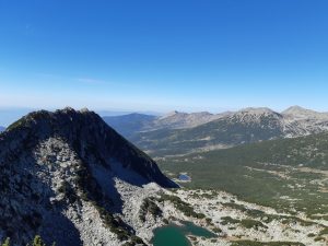
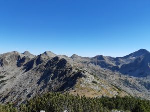
From here the real fun starts. Simply put head west along the ridge until you come the summit of Mozgovishki Chukar about 90 minutes from this peak! In reality the ridge is nothing but trouble and at times technical scary trouble at that.
The ridge starts easily enough with some grass and the odd boulder or patch of kelk to circumvent. The further along the ridge you go the bigger the boulders get and the thicker the patches of Klek become. I’ve tried every possible variation of this ridge and even though it is a bit scary at times the best route is to follow the highest point of the ridge. It’s not easy. The boulders are huge in places and some of the moves are almost rock climbing. The patches of Klek are a huge pain in the bum but it’s better to fight through them than try to detour around them.
 The summit is very very satisfying. We didn’t need a rope but I think some people would like to have one. We didn’t do any actual climbing but there are two sections, The Crack and The ledge where a good pair of shoes and strong fingers are essential.
The route home is back the way you came so you will get a chance to experience those exciting bits descending now! Go carefully, a buddy to spot foot holds is useful.
When you get back to #46 the peak next to Pitel carry on directly east along the ridge towards Tevno hut. This is pretty easy going after the boulder fields you have just crossed. Soon you will see the red trail below you and the little lake where you turned off the blue trail. At this point you can follow the faint goat trail directly down to the lake. It is almost a perfectly straight line. If you have not had enough excitement varry on along the main ridge towards Tevno. Descend here via the winter route marked with the yellow and black poles, there is also a chain to help winter climbers.
Follow the Blue trail back to Damianitsa hut. As I said at the beginning this is a long day. Added to that it is a dry route so you will need to carry lots of water and food. Expect it to take you 12 hours at a good pace from Damianitsa hut. The views are unique and you will get a real feeling of being an explorer adventuring in untamed lands. This almost untouched route, during the 10 recces I have made on this route I have only seen 2 other people on the main ridge.